Taking RADMApp to the Next Level
We are thrilled to share that Aquatera Ltd has been awarded a Research and Innovation Grant from Highlands and Islands Enterprise (HIE) Innovation and Knowledge Transfer Programme, that will be instrumental in helping us to significantly improve and optimise our in-house developed GIS tool, RADMApp (Resource Analysis and Digital Mapping Application) - enhancing its capabilities and efficiency for all our users.
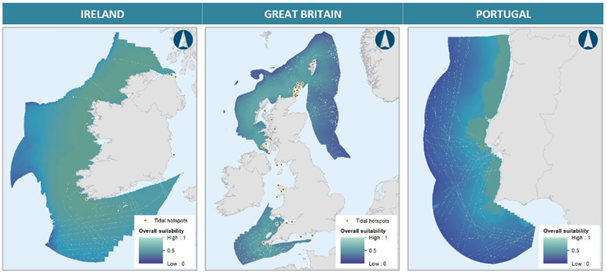
Aquatera’s RADMApp tool is a raster-based GIS framework for data analysis that can be applied to many different scenarios. The tool helps to establish a robust framework by identifying the key decision factors and types of data that need to be considered during site selection: from planning zones and conservation designations, to available wind, tide, wave, and solar resources, and social, cultural, and economic activity data. It provides a universal and comparable system for classifying the levels of suitability for each criteria, so each one can be scored and weighted to identify suitable site options.
This method has been used on a wide range of projects across the globe for over 20 years to support spatial analysis and site selection across various sectors, particularly in renewable energy and infrastructure planning.
The goal of this new development activity is to automate and streamline the processes involved to improve the efficiency and standardise the consistency of RADMApp’s outputs, to be able to better serve specific repeatable use-cases.